
Early knowledge beats late surprises. Site preparation works best when crews can see what sits below the surface, not just what is on a plan sheet. Practical underground scanning turns unknowns into knowns, so excavation, sawcutting, and drilling happen with fewer delays, fewer change orders, and fewer safety risks. The payoff shows up in saved time, steadier budgets, and cleaner coordination across trades.
What Underground Scanning Actually Finds
Underground scanning paints a picture of the subsurface so teams can make smarter choices before tools hit the ground. Crews use it to locate utilities, voids, old foundations, and changes in slab thickness. The results help set drilling locations, trench routes, and laydown areas that won’t trigger headaches later.
Ground penetrating radar uses high-frequency radio waves to spot buried lines without digging, including non-metal targets like PVC and concrete-encased conduits. That capability fills gaps left by metal-only locators and helps teams map congested corridors with more confidence.
Why It Matters Before You Dig
Hidden conflicts are budget traps. A misjudged trench path can block another trade, force a redesign, or require extra traffic control. Teams look for ground penetrating radar services to map utilities before any sawcut, and that single phone call can prevent needless change orders. Scanning places real-world feedback into the plan so crews work around risks and keep the schedule moving.
The approach reduces the odds of striking a service that feeds the same jobsite. It keeps inspectors on your side because field decisions line up with what the scan already proved.
Fewer Strikes, Fewer Delays
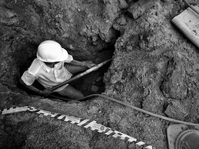
Damage to underground utilities is more than a paperwork issue. A strike can halt an entire site for hours while owners, insurers, and safety officers sort things out. Traffic gets rerouted, trench boxes sit idle, and crews miss targets that were otherwise within reach.
The 2024 CGA Dirt Report reviewed 196,977 damage cases in 2024, a scale that highlights how often these incidents still occur. Scanning removes many of the surprises that create those numbers. When subsurface data is shared across the team, foremen plan around hazards and avoid the chain reaction that follows a strike.
Method Strengths and Limits You Should Plan Around
GPR excels when materials and soil conditions cooperate. Dry, sandy soils and clean concrete yield clear reflections. The method can work around rebar mats when operators adjust frequency, grid spacing, and gain settings to match the structure they are reading.
Moist clays and highly conductive soils can dampen the signal and shorten the depth. Metallic clutter can mask targets. The practical answer is planning, so use the right antenna for the depth, add markouts from 811 tickets, review as-builts, and run tight grids in critical areas like electrical rooms and utility corridors.
- Scan high-risk work zones first
- Combine scan data with utility records and 811 responses
- Mark findings on the surface and in shared digital maps
- Re-scan immediately before coring or sawcutting
Industry Progress Has a Long Way to Go
Damage numbers show that awareness alone is not enough. Busy jobsites juggle schedules, subcontractors, and permit clocks. Even with good intentions, a rushed decision can bypass a scan and invite trouble.
Compact Equipment covered the CGA’s view that the industry is not on track to meet the 50-in-5 damage reduction goal. That assessment points to a simple takeaway for site prep: treat scanning as a standard early step, not a special request. When it becomes routine, the whole project benefits from safer planning and steadier productivity.
How to Make Scanning Practical on Your Project
Define the work area, depth targets, and key conflicts like known duct banks or chilled water lines. Ask for grids in tight rooms, wider passes in open areas, and clear deliverables such as markouts, sketches, and a summary your superintendent can use in the morning huddle.
Follow through in the field. Keep the scanner near the head of the work, share findings with every foreman who might cross the area, and rerun passes if weather or phasing changes conditions. A little discipline sets up the rest of the job, from trenching and dewatering to slab coring and signpost foundations.
A well-prepared site feels different. Crews move with purpose, not hesitation. Saws and augers start where they should, inspectors sign off faster, and nearby businesses or tenants experience less disruption. That looks like professionalism to the client and builds trust with the public.
Smart projects reduce risk at the source. Underground scanning supplies the facts that keep people safe and work flowing. Put it early in the plan, share the data widely, and watch the site run cleaner from day one.