
Introduction: Why Construction and Survey Industries Are Rapidly Adopting Drone Solutions
Drone solutions for construction act as a bridge connecting physical job sites with digital workflows. Construction and land development projects are subject to tremendous pressure to enhance efficiency, maintain safety, and minimize costly mistakes. Drones provide accurate data needed in modern geospatial intelligence and automation.
Traditional manual methods often struggle to provide the real-time visibility needed today. The lack of precise position data makes it challenging to align BIM designs, road vector maps, and satellite imagery, costing time and labor.
Drones address manual inspection challenges head-on, adopting autonomous drone technology with speed and precision to streamline operations and deliver measurable results.
Understanding Drone Solutions in Construction and Surveying
Drones solutions in an enterprise context mean more than camera flying. An entire ecosystem entails three main parts that are working seamlessly.
1. Autonomous UAV Platforms
Multi-rotor drones like Matrice 350 RTK allow inspection of the vertical and shrubs due to their stability and maneuverability.
Fixed-wing vertical take-off and landing (VTOL) drones have a great range of coverage. These are used in autonomous operation using flight plans, which are programmed in advance and provide reliable data capture every time.
2. Advanced Sensor Payloads
The sensor dictates the data quality.
RGB Cameras: Capture high-resolution photogrammetry for orthomosaics.
LiDAR Sensors: Lasers that penetrate canopy cover to map the ground beneath vegetation.
Thermal Cameras: These detect heat leaks in buildings or overheating machinery.
Multispectral Sensors: Analyze vegetation health for environmental impact assessments.
3. Data Processing and Analytics
The data is gathered by hardware, and the value is generated by software. Many platforms, such as DroneDeploy, assemble thousands of images in 3D point clouds and digital surface models (DSMs).
These tools process raw gigabytes and transform them into insights that engineers can use instantly.
According to Advexure, the shift in 2025 is toward "all-in-one" payloads that combine these sensors, allowing pilots to capture visual, thermal, and laser data in a single flight. This consolidation saves a significant amount of time on-site.
How Drone Technology Is Reshaping Construction Workflows
Pre-Construction Planning and Site Intelligence
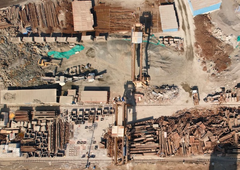
Accurate pre-construction data is essential in preventing budget overruns. Drone technology in construction simplifies the initial land assessment and complex terrain modeling. Aerial data is used for precise map topography and volume measurements.
According to the data provided by JOUAV, drones can accomplish survey tasks 60% to 70% faster than traditional ground-based solutions. This speed greatly increases the process of permitting and feasibility analysis without compromising quality.
Construction Progress Monitoring and Reporting
Maintaining different stakeholders on track is an activity that needs regular and clear communication. Automated aerial tracking provides refutable evidence of progress on the site.
These datasets are built into the BIM, CAD, and project management software.
Feature | Traditional Monitoring | Drone-Based Monitoring |
Frequency | Weekly or Monthly | Daily or On-Demand |
Perspective | Ground-level only | Full aerial site overview |
Data Type | Manual logs/photos | Measurable 3D models/orthomosaics |
Speed | Slow, labor-intensive | Rapid, automated capture |
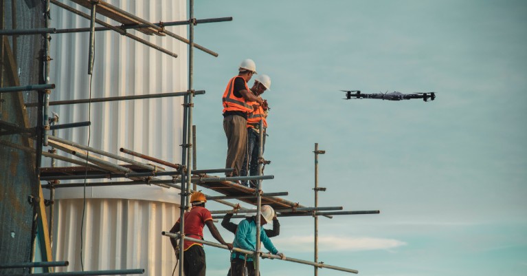
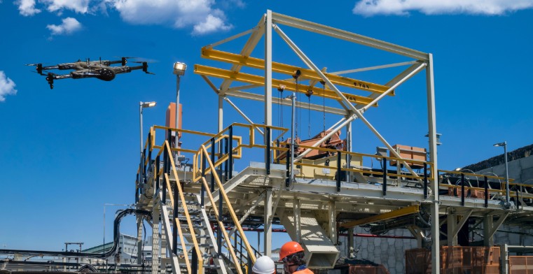
Safety Management and Compliance Monitoring
The nature of construction sites is dangerous. Drones allow remote inspection of hazardous areas without risking human lives. They enable early identity detection of structural risks or unstable earthworks.
A report cited by Cal Poly (referencing PwC) stated that drone surveillance can prevent life-threatening accidents on construction sites by 91%. This dramatic increase is due to the elimination of workers in areas exposed to dangerous heights and machinery.
Advanced Drone-Based Land Survey and Data Collection
Modern projects necessitate high-accuracy land surveying over huge regions. Drone land surveying, applying RTK (Real-Time Kinematic) positioning, competes with traditional ground surveying.
The introduction of LiDAR drone surveying has revolutionized aerial surveying and mapping. This combination offers benefits to traditional means of surveying, especially in terms of availability and cost-effectiveness.
For teams requiring top-tier precision, investing in high-accuracy survey drones is essential. Multirotor drones are capable of providing the data reliability required in making intense engineering decisions.
Improving Accuracy, Speed, and Cost Control with Drone Solutions
Employing aerial data collection reduces operational downtime. Drones are capable of capturing data over large project fields faster than ground crews.
Less Labor: Limits the necessity of massive field crews in hazardous terrain.
Faster Turnaround: Data processing can be done within the day instead of taking weeks.
Cost Efficiency: According to AlterSquare, drone surveys can save up to 50-70% in costs of infrastructure inspections in comparison to the traditional methods.
Lastly, such efficiencies result in a long-term cost reduction throughout the project life cycle.
Autonomous Drones and AI in Construction and Survey Projects
The industry is shifting towards full autonomy in flight planning for repetitive missions. AI-powered images find objects, progress changes, and possible defects in the shortest amount of time.
These automated systems make the processes of measurement and reporting easier and less prone to human error. Such an automation enables multi-site distributed construction sites to be scaled.
Drone as a Service (DaaS): A Scalable Model for Construction Firms
Drone as a Service (DaaS) is an outsourced business model that is popular with many firms. This model does not require high capital investment in almost outdated hardware that drives most forward-thinking businesses to use Drone as a Service (DaaS) .
Why Choose DaaS?
Instead of shouldering the burden of ownership, you partner with a dedicated provider. This model converts a heavy capital investment into an operating cost.
Zero Capital Expenditure: You do not spend thousands of dollars on hardware that may become obsolete in two years. You gain access to cutting-edge platforms, such as the ZenaDrone 1000 for heavy-lift inspection or the IQ Quad to survey with a high level of precision without initial cost.
Expert Compliance: The FAA waivers, airspace unlocks, and flight logs are dealt with by professional providers. You ask for the data; the service staff enforces the regulations.
Immediate Scalability: DaaS lets you implement the appropriate tool for the task, whether it is an indoor scan with the IQ Nano or a large-scale topographical map.
By outsourcing to a professional DaaS provider, you concentrate on interpreting the data to develop big projects, rather than worrying about collecting it.
Data Accuracy, Security, and Regulatory Considerations
Data integrity and secure cloud storage practices should also be part of the enterprise operations.
Airspace Compliance: Adherence to local aviation authority rules (e.g., FAA Part 107 in the US).
Data Security: Keeping the proprietary site data in encrypted and secure servers.
Partner Selection: Collaboration with long-term construction drone services providers will reduce legal risks.
The Future of Drone Solutions in Construction and Surveying.
The future is in the development of dynamic digital twins and real 3D models of the site. We will witness more integration with IoT sensors and GIS in innovative infrastructure development. Predictive analytics will make project schedules optimal using historical aerial data patterns.
Conclusion: Drone Solutions as a Competitive Advantage
The revolution of drone technology has been proven to have transformational value. Drones are not merely novelties anymore; they are tools of the industry. Construction and survey organizations implementing these solutions have enormous competitive value in the long term.
Contact us today to discuss how our tailored Drone Solutions for Construction and Survey Projects can deliver the precise data you need, faster than ever before.